


Fact Check · The Bahamas
No official agency has confirmed it, and the U.S. Geological Survey has no record of it. Here is where the alert came from, why it spread so fast, and how to check before you share.
By Michael Elijah Muhammad Clare
Thursday, November 19, 2026
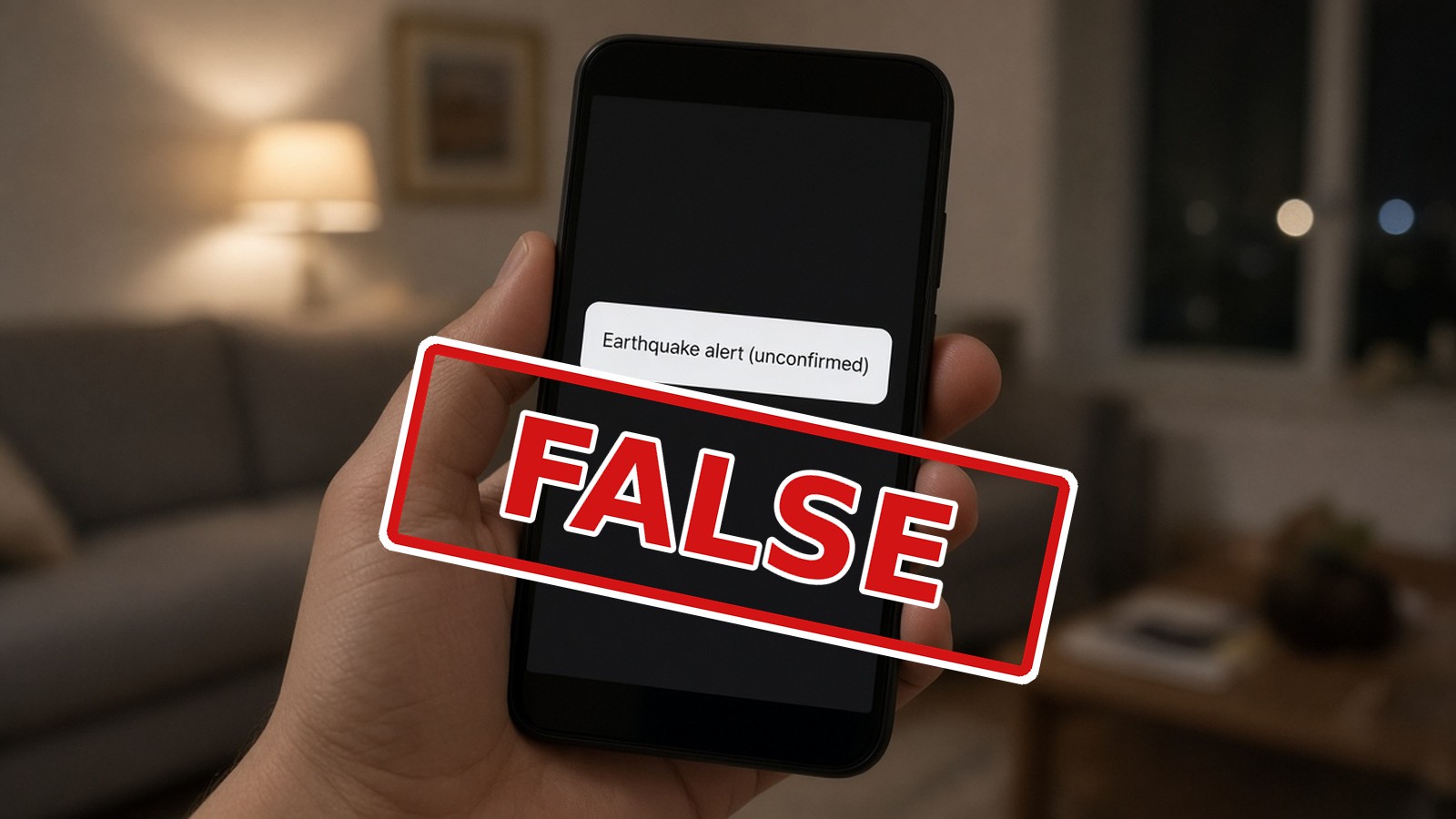
In the early hours of Thursday, November 19, 2026, an alert began moving across the internet: a magnitude 5.2 earthquake had struck the Atlantic about 96 km (60 miles) east of Freeport, Grand Bahama.
It sounded official. It had a magnitude, a depth, and a location down to a named cay. By morning, people across The Bahamas were asking whether it was real.
No official agency has confirmed an earthquake, and the U.S. Geological Survey has no record of one. We found no confirmation from Bahamian authorities either.
lol242 checked the record. Here is what we found.
The Facts at a Glance
- The claim: a magnitude 5.2 earthquake about 96 km (60 miles) east of Freeport, early Thursday, November 19, 2026
- Where it came from: a preliminary, automated alert on the quake-tracking website VolcanoDiscovery
- Confirmed by Bahamian authorities: No confirmation found
- In the U.S. Geological Survey’s records: No
- Damage or injuries: None reported
- Tsunami threat: None in effect
- Other unconfirmed alerts: a “magnitude 5.7” east of Abaco on November 6, and a “magnitude 3.5” near Mayaguana on November 19
No Record Where It Counts
The U.S. Geological Survey (USGS) keeps one of the most widely used public records of earthquakes anywhere in the world. A search of its records covering all of The Bahamas, from November 1 to November 19, 2026, came back with zero earthquakes of magnitude 2.5 or higher. Not the 5.2 near Grand Bahama. Not anything.
An earthquake that size, that close to Florida and the busy northern Bahamas, is exactly the kind of event official networks pick up and post quickly. Its absence speaks loudly.
We found no confirmation from Bahamian authorities either, and there have been no reports of damage, injuries or any tsunami threat.
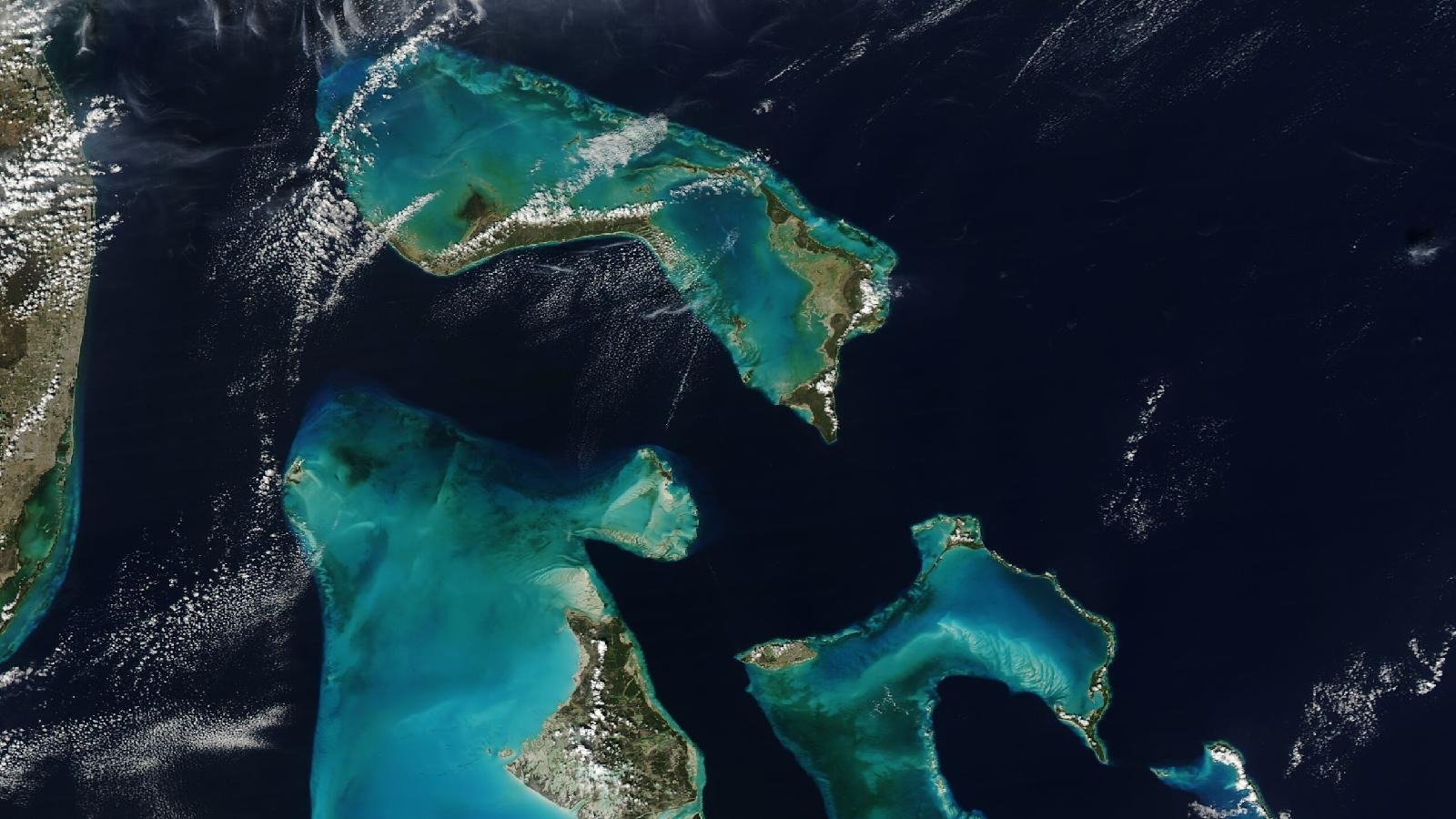
The northern Bahamas from above. No official agency has confirmed an earthquake here on November 19. Image: NASA
Where the Alert Came From
The alert was published by VolcanoDiscovery, a popular website and app that tracks volcanoes and earthquakes around the world. It is fast, often posting within minutes. To be that fast, it shows preliminary readings, including ones from automated systems and citizen seismic networks: low-cost sensors that schools, hobbyists and homeowners set up around the world.
Those networks do valuable work. But the site’s own pages say plainly that such details are preliminary until confirmed by a seismic agency, and it labels some events “unconfirmed.”
Here is the problem. When only a few sensors pick up a signal, and those sensors are far from where the shaking supposedly happened, a computer can mistake background noise or a distant quake for a local one, or badly misjudge its size and location. That is why a preliminary alert is a starting point, not a fact.
The alert also carried a telling detail: when it went out, it listed just one report from someone who said they felt it. Real earthquakes of that size near populated islands usually bring a flood of “did you feel that?” reports. This one had one.
How It Spread
From there, the alert travelled the way most rumours travel now. It was copied, shared and repeated. Some AI chatbots, which pull from the same websites, repeated it as settled fact, complete with distances, depth and talk of light shaking near the epicentre.
It was not the first time this month. A similar alert on Friday, November 6, claimed a “magnitude 5.7” quake in the Atlantic east of Abaco. That one has no record in the USGS catalogue either. Neither does a smaller “magnitude 3.5” alert near Mayaguana posted on Thursday.
Why a 5.2 Here Would Have Been Huge News
Part of what made the alert so gripping is how rare real earthquakes are in The Bahamas. That same rarity is exactly why it needed checking.
About nine in ten of the world’s earthquakes happen along the edges of the giant plates of the Earth’s crust. The Bahamas sits on a vast limestone platform on the North American Plate, and the nearest plate boundary runs just south of Cuba and through Hispaniola, about 470 miles (750 km) from Grand Bahama, and closer to our southern islands. A regional hazard study by the Organization of American States noted that, of all the Commonwealth Caribbean countries, only The Bahamas and Guyana do not lie close to those plate boundaries. The World Bank-backed ThinkHazard tool rates our earthquake hazard as very low, and quake trackers note that no damaging earthquake has ever been recorded here.
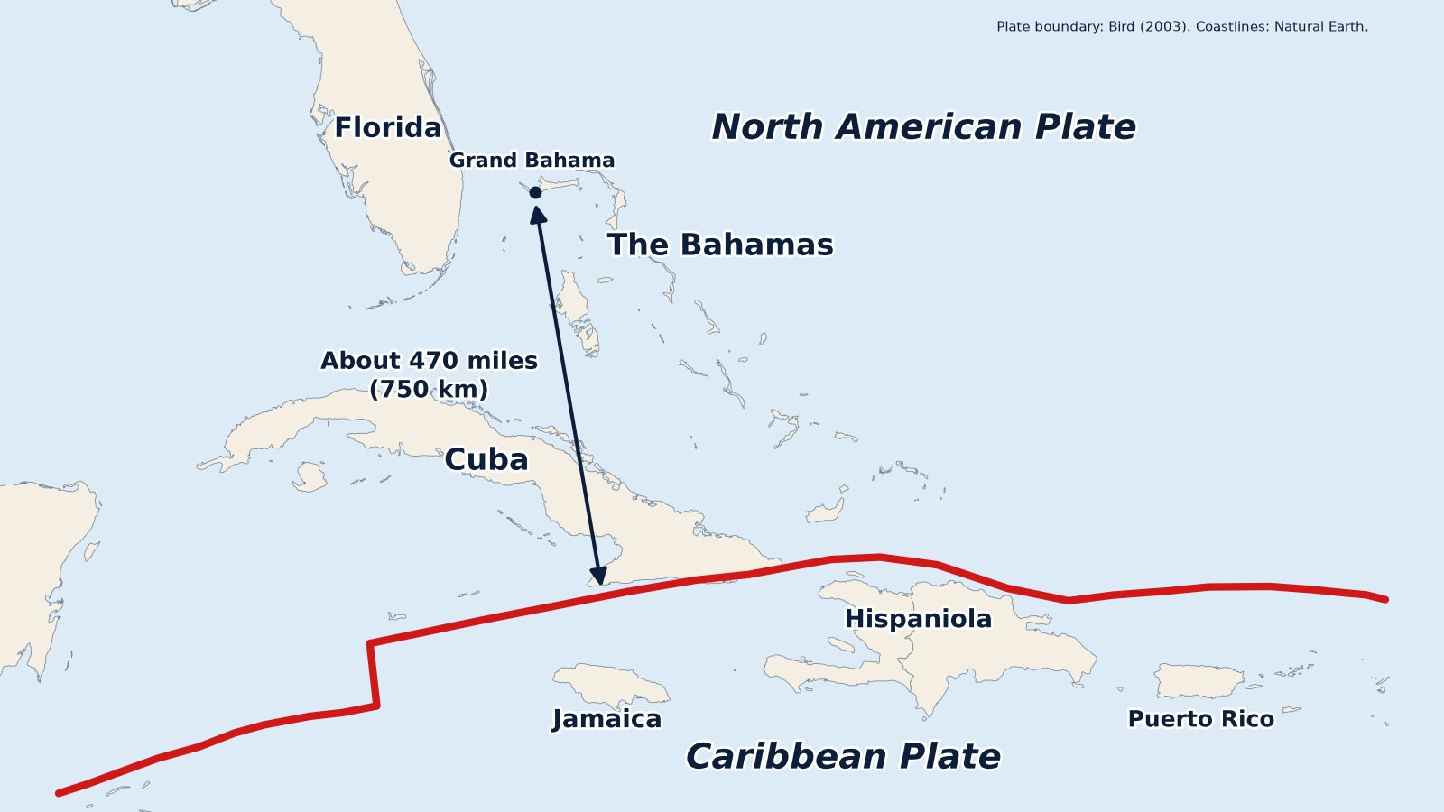
The nearest plate boundary runs just south of Cuba and through Hispaniola, about 470 miles (750 km) from Grand Bahama. Map: lol242, using Natural Earth data
Quake records show just one earthquake near West Grand Bahama since 1900: a magnitude 3.2 about 27 km southwest of Freeport, in February 1992. No significant earthquake has been confirmed in or near Nassau since 1900. The last time the capital truly felt one was January 28, 2020, when a magnitude 7.7 quake between Jamaica and Cuba sent tremors along East Bay Street.
Quake trackers say The Bahamas averages only about five small earthquakes a year, most too weak to feel, and a magnitude 4 roughly once every two years. Before this month’s unconfirmed alerts, one quake catalogue going back to 1900 listed nothing in or near The Bahamas stronger than a magnitude 4.5. A real 5.2 off Grand Bahama would have topped that entire record.
Extraordinary claims need extraordinary proof. This one never had any.
Before You Reach for Revelation
In a praying nation, news of an earthquake can send people straight to the Bible, to Matthew 24 and the sixth seal. But Scripture also has something to say about rumours.
“The simple believeth every word: but the prudent man looketh well to his going.”
Proverbs 14:15 (KJV)
Jesus told His followers they would hear of wars and rumours of wars, and to “see that ye be not troubled” (Matthew 24:6). And Paul’s advice to the church at Thessalonica works just as well for a screenshot on WhatsApp: “Prove all things; hold fast that which is good” (1 Thessalonians 5:21).
How to Check Before You Share
- Go to official sources first. In The Bahamas, that means the Bahamas Department of Meteorology, the Disaster Risk Management Authority and the Office of the Prime Minister.
- Check the USGS. The U.S. Geological Survey lists confirmed earthquakes worldwide at earthquake.usgs.gov. If a quake that size is real, it will usually be there.
- Read the small print. Words like “preliminary,” “automatic” or “unconfirmed” mean no official agency has checked it yet.
- One app is not confirmation. Wait for a second, official source.
- Ask who felt it. Real quakes near people bring many felt reports, not one.
- Don’t trust a chatbot on breaking news. AI tools can repeat a bad alert as if it were fact.
- Screenshots are not sources. If a post has no source, don’t pass it on.
If the Earth Ever Does Move
Our risk is very low, but it is not zero. If you ever feel shaking, Drop, Cover and Hold On: get under a sturdy table and hold on until it stops. Stay clear of windows and anything that could fall. If you live on the coast and feel strong shaking that lasts, move inland or to higher ground, and wait for official word from the Department of Meteorology and the Disaster Risk Management Authority.
The ground under The Bahamas stayed still on Thursday. The internet did not.
At lol242, we checked before we posted. We hope you will too.
Sources: U.S. Geological Survey; VolcanoDiscovery; U.S. Tsunami Warning Centers; Organization of American States; ThinkHazard (World Bank GFDRR); WorldAtlas; Miami Herald; Office of the Prime Minister (January 2020 earthquake statement); Disaster Risk Management Authority; NASA; Natural Earth; The Holy Bible, King James Version
Related stories

Bahamas Midday Briefing: News Headlines – Thursday, November 19, 2026
The Government says it is pushing ahead with its new Oracle payroll system despite…
Bahamas Morning Briefing: News Headlines – Thursday, November 19, 2026
Thursday’s lol242 Bahamas Morning Briefing covers a possible weekend storm system near the northern…
Bahamas Evening Briefing: News Headlines – Wednesday, November 18, 2026
By Michael Elijah Muhammad Clare Wednesday, November 18, 2026 Good evening, Bahamas. Tonight: a…
